
Modern Flood Monitoring for Municipal Governments
Deploy city-wide flood monitoring without building local networks. No LoRaWAN gateways, no radio infrastructure. Just reliable alerts when your community needs them.
The Flood Challenge Facing Cities and Towns
Texas municipalities face unique flood monitoring challenges that traditional systems were not designed to address.
Delayed Warnings
Regional flood alerts often arrive too late for local action. By the time warnings reach your EOC, roads may already be impassable.
Limited Coverage
State and federal monitoring networks have gaps. Your flood-prone neighborhoods and low-water crossings may not be covered.
Budget Constraints
Traditional flood monitoring systems require significant investment and complex procurement that many municipalities struggle to navigate.
Resident Safety
Without hyper-local data, emergency managers cannot provide timely warnings to residents in the most vulnerable areas.
Why Traditional Systems Require Too Much Infrastructure
Legacy flood monitoring systems require cities to build and maintain complex local networks that strain budgets and IT resources.
LoRaWAN Gateway Networks
Traditional systems require deploying and maintaining local gateway infrastructure across your coverage area.
Radio Infrastructure
Legacy flood systems depend on radio networks that require FCC licensing, tower maintenance, and specialized expertise.
Complex Multi-Vendor Installs
Traditional flood gauges require sourcing sensors, loggers, and communication equipment from multiple vendors, then integrating them yourself.
Single Point of Failure
When local cellular towers or power goes down during storms, traditional systems lose connectivity exactly when needed most.
Limited Scalability
Infrastructure requirements make it impossible to deploy comprehensive coverage across all flood-prone areas.
No Mass Notification
Traditional systems often lack integration with emergency notification platforms for alerting residents.
How Levelynx Modernizes Municipal Flood Warning
Levelynx eliminates the infrastructure burden of traditional flood systems. No gateways to deploy, no radio networks to maintain. Each sensor connects directly via cellular or satellite, with automated alerts to staff and residents included.
No Local Network Required
Deploy city-wide without building LoRaWAN gateways or radio infrastructure. Each sensor connects directly to the cloud.
Satellite Backup
When cellular towers fail during storms, satellite connectivity ensures your flood data still gets through.
Flexible Pricing
Multiple pricing options available. Predictable costs that fit municipal budgets.
Rapid City-Wide Deployment
Sites operational in under an hour. No contractors, no permits, no infrastructure buildout required.
60GHz Radar Accuracy
Millimeter-precise measurements unaffected by debris, foam, turbulence, or weather conditions.
WeatherCall Integration
Automated mass notifications to city staff and residents through phone calls, texts, and emails.

Radar Sensor
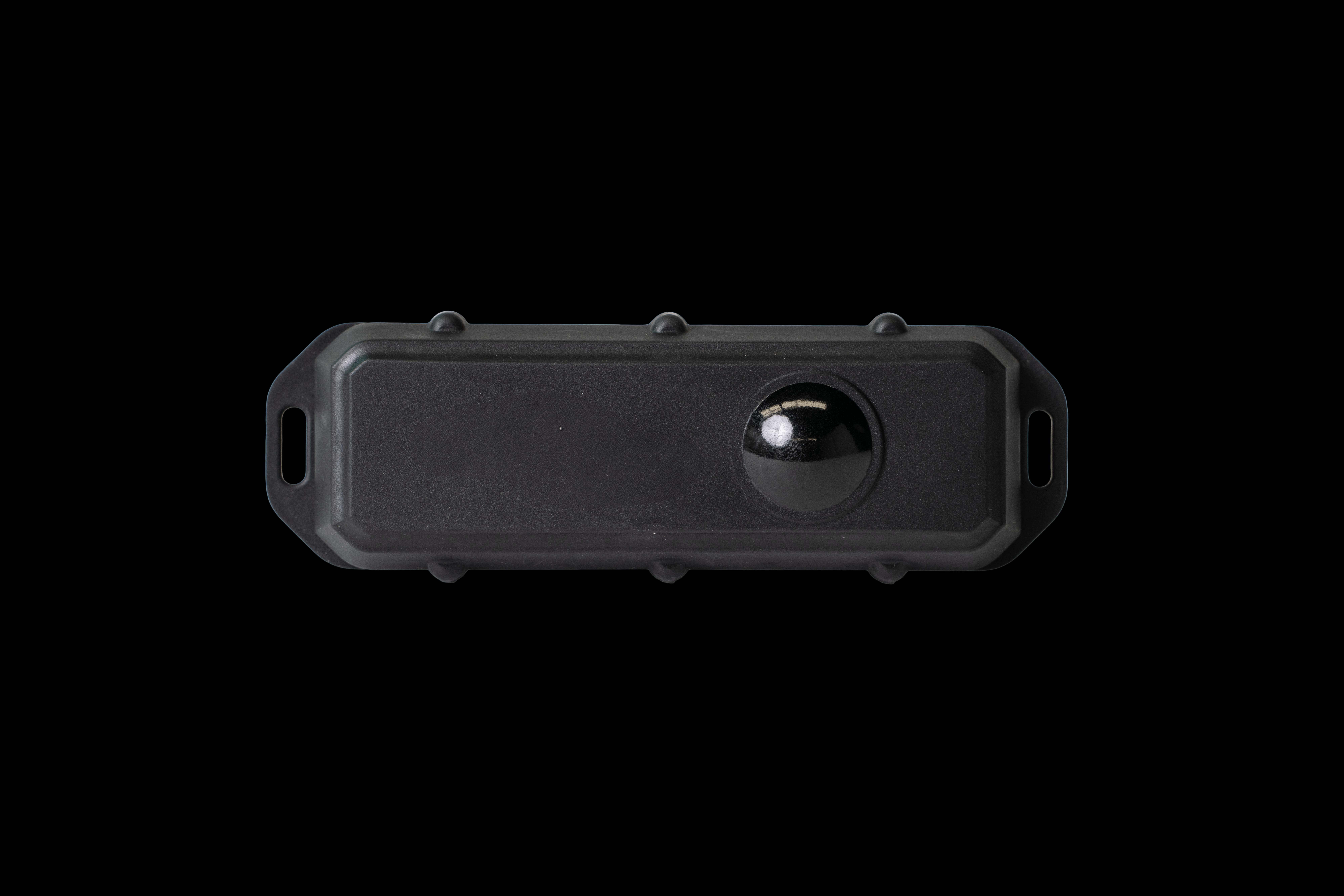
Top View
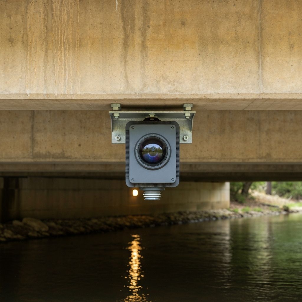
Mounted under bridge
Alerting Both City Staff and Residents
When water levels reach your defined thresholds, Levelynx automatically notifies city staff, first responders, and residents through WeatherCall integration — no manual intervention required.
Automated Phone Calls
Critical alerts delivered via automated voice calls to staff, first responders, and residents.
SMS Text Messages
Instant text notifications reach mobile devices even when internet connectivity is limited.
Email Notifications
Detailed alerts with water level data and historical context for informed decision-making.
Siren Integration
Trigger outdoor warning sirens automatically when water levels reach critical thresholds.
Staff Notifications
Alert public works crews, emergency coordinators, and city management simultaneously.
Resident Alerts
WeatherCall integration enables mass notification to residents in affected areas.
WeatherCall Integration
Levelynx integrates with WeatherCall to combine real-time water level data with severe weather alerts. When flooding conditions develop, residents receive coordinated notifications through multiple channels simultaneously.
- Geographically targeted alerts
- Multi-language support
- Delivery confirmation tracking
- Integration with local emergency plans
FLOOD ALERT
Water Level Warning
Location
Main St. Bridge
Current Level
8.2 ft
Above warning threshold
Action Required
Avoid low-water crossings in the area. Monitor for updates.
Integration with Existing Emergency Response Plans
Levelynx is designed to complement and enhance your existing emergency management infrastructure, not replace it.
Works With Your Systems
Our cloud platform integrates with the tools your team already uses, providing water level data where and when you need it.
- Emergency Operations Center (EOC) dashboards
- Existing mass notification systems
- SCADA and public works systems
- GIS and mapping platforms
- Historical data reporting tools
- Incident management software
Supports Your Protocols
Configure Levelynx to match your emergency response procedures and escalation protocols.
Pre-Event Monitoring
Continuous water level tracking with trend analysis helps identify developing conditions before they become emergencies.
Threshold Alerts
Customizable alert levels aligned with your emergency response protocols. Warning, watch, and emergency thresholds.
Automated Response
When thresholds are crossed, notifications are automatically sent according to your defined escalation procedures.
Real-Time Coordination
Shared dashboard access keeps all stakeholders informed with the same real-time data during events.
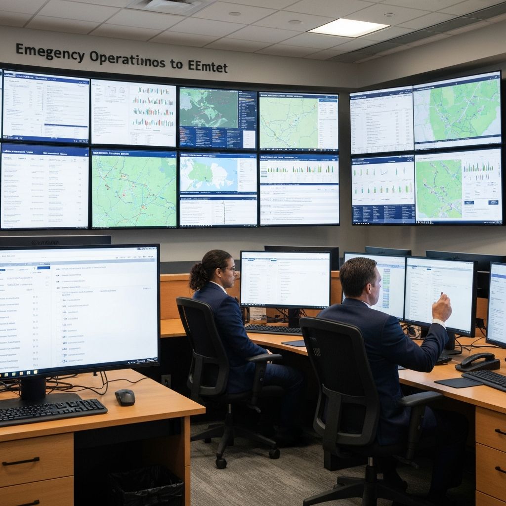
Real-time data for your EOC
Access water level data, historical trends, and alert status from any device. Perfect for emergency operations centers and remote monitoring.
Scalable Deployment from Single Locations to City-Wide Networks
Start small and expand as needed. Our flexible model makes it easy to add sites as your monitoring needs grow.
Single Location
Start with one critical monitoring point — a flood-prone bridge, detention pond, or drainage channel.
Ideal for: Pilot programs, specific problem areas
Neighborhood Coverage
Deploy multiple sensors across a flood-prone area to provide comprehensive early warning for residents.
Ideal for: Flood districts, vulnerable neighborhoods
City-Wide Network
Comprehensive coverage across all major waterways, drainage infrastructure, and flood-prone areas.
Ideal for: Municipal-wide flood monitoring
County-Wide System
Regional deployment covering multiple communities, rural areas, and county infrastructure.
Ideal for: County emergency management

Volume Pricing for Municipalities
As your deployment grows, per-site costs decrease. We offer custom pricing for municipal networks that makes comprehensive coverage achievable within operational budgets.
- Multi-year agreement discounts
- Predictable annual budgeting
- No surprise maintenance or replacement costs
- Dedicated municipal support team
Ready to Protect Your Community?
Join Texas cities and towns already using Levelynx to deliver faster, more reliable flood warnings to their residents.
Serving cities, towns, counties, and emergency management agencies across Texas.