
Mission-Ready Flood Monitoring for Defense
Military installations and training ranges span vast, often remote terrain where flooding threatens personnel safety, range access, and mission readiness. Levelynx delivers rugged, self-powered flood monitoring with satellite-backed connectivity that works far beyond commercial coverage — keeping commanders informed and people safe.
Flood Awareness for Remote, Demanding Terrain
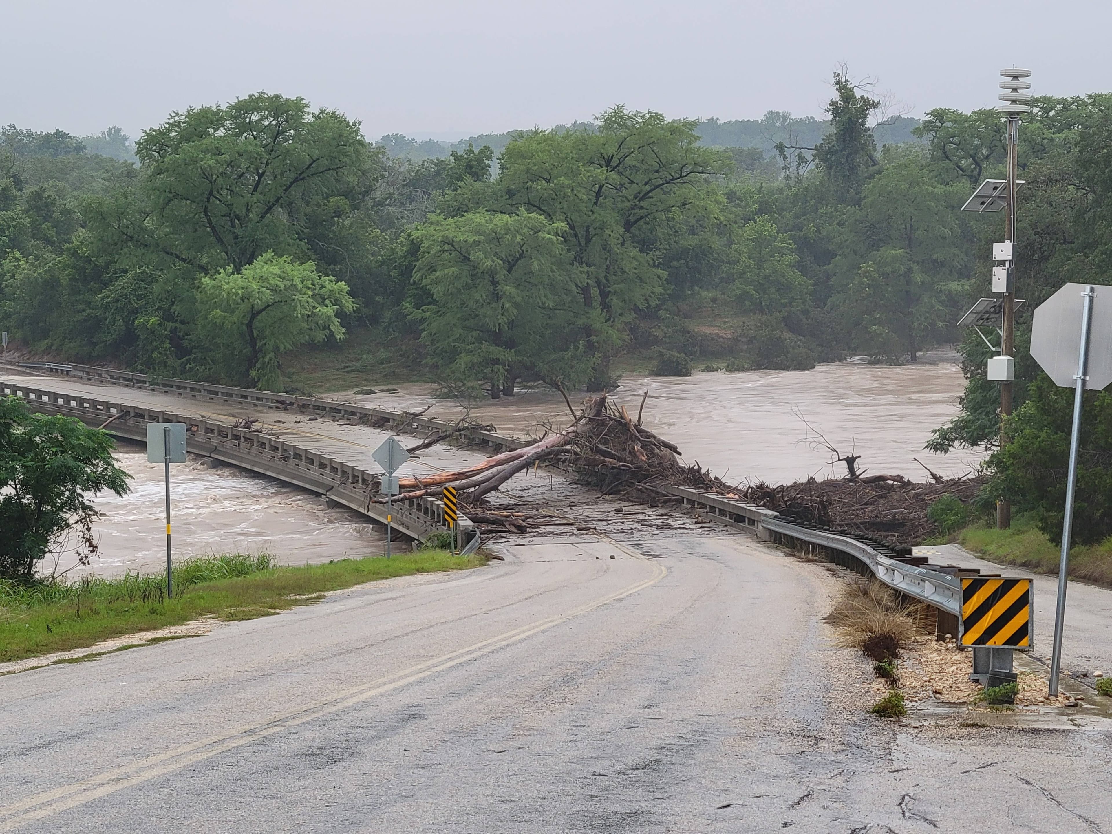
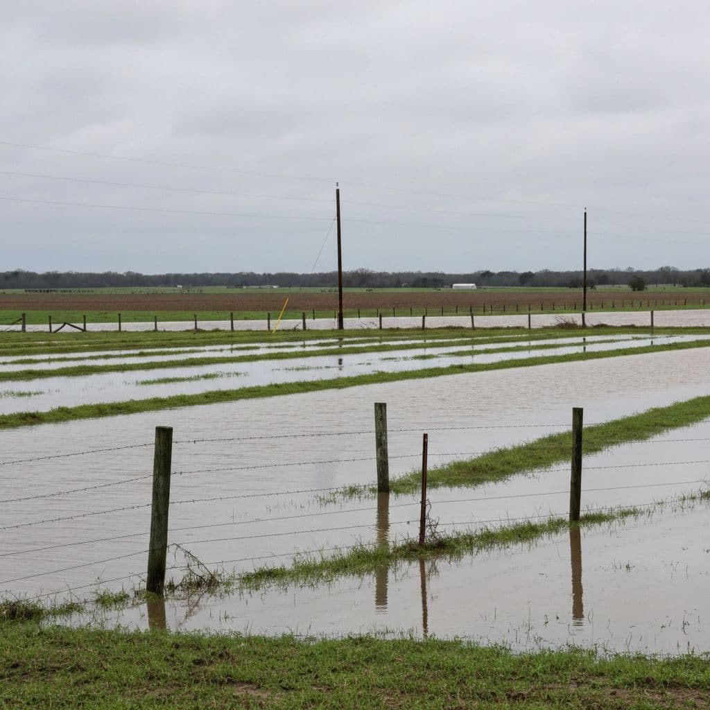
Installations and training areas contain low-water crossings, tank trails, and range roads that flood quickly and dangerously — frequently in areas with no commercial cellular coverage and no power. Loss of awareness at these points puts personnel at risk and disrupts training and operations.
Levelynx is built for exactly these conditions. Self-contained nodes run on solar with long battery backup, automatically fall back to satellite when there is no cellular signal, and survive harsh environments. The result is real-time water-level awareness and automated alerts across the installation, without standing up new infrastructure.
Defense Mission Requirements
Beyond-Coverage Connectivity
Automatic satellite fallback keeps data flowing in remote ranges and training areas where commercial cellular does not reach.
Crossing & Range Access
Monitor low-water crossings, tank trails, and range roads so commanders know in real time when a route becomes impassable.
Force Protection
Automated alerts warn personnel before water makes a crossing or low-lying area dangerous, reducing risk during training and operations.
Self-Powered & Rugged
Solar power with up to 6 months of battery backup and a rugged, submersion- and impact-rated enclosure withstand harsh field conditions.
Rapid, Infrastructure-Free Setup
Deploy across an installation in hours, with no need to build out networks or power at each remote site.
Operational Awareness
Real-time dashboards and an open API integrate water-level data into the command and operations systems you already use.
How Defense Organizations Use Levelynx
Rugged monitoring that protects personnel and keeps training and operations on schedule.
Low-Water Crossings & Tank Trails
Monitor the crossings and trails that flood during exercises and storms. Automated alerts and real-time depth data help range control and unit leaders keep personnel and vehicles out of dangerous water.
Range & Training-Area Awareness
Track flooding across remote training areas where there is no cellular coverage, using satellite-connected nodes that report continuously and survive the field environment.
Installation Force Protection
Integrate water-level data and automated warnings into installation operations and emergency systems, supporting force protection and continuity during severe weather.
Why Defense Organizations Choose Levelynx
- Automatic satellite fallback for beyond-cellular ranges and training areas
- Solar power with up to 6 months of battery backup at off-grid sites
- Rugged enclosure rated for submersion and impact in the field
- Rapid, infrastructure-free deployment across large installations
- Automated alerts to protect personnel at dangerous crossings
- Sub-centimeter water-level accuracy for confident decisions
- Open API integration with operations and emergency systems
- Your data stays yours — no mandatory vendor portal
Your Data Stays Yours
Public agencies are stewards of public data. Levelynx is built around transparency and portability — no hostage data, no mandatory portal, no surprises.
You Own All Collected Data
Every reading from every sensor belongs to your agency — not to us. We are the platform, you are the owner of record.
Data Export Available
Export your full dataset on demand in standard formats for reporting, analysis, or archival.
Open APIs
Documented, open APIs let you push data into your CAD, GIS, EOC, hydrologic models, and public dashboards.
No Vendor Lock-In
Open standards and exportable data mean you are never trapped. Your investment and your records stay portable.
Historical Archive Access
Retain and access the full historical record for trend analysis, capacity planning, and regulatory reporting.
Start With a Pilot, Not a Purchase Order
Prefer to see it work before funding a full rollout? Choose the evaluation path that fits your timeline and budget cycle. We're happy to start small and prove the value first.
30-Day Pilot
Deploy a small set of nodes at your most critical locations and see real data from your own sites within a month.
60-Day Evaluation
Run an extended evaluation across more locations and seasons to validate alerts, accuracy, and integrations before you commit.
Proof of Concept
Define success criteria with our team and prove the system against them — ideal for justifying a larger funded rollout.
Protect Personnel and Mission Readiness
Talk with our team about flood monitoring for your installation's crossings, ranges, and remote training areas.