Flood Monitoring for Federal Agencies
Federal agencies set the standard for hydrologic data, flood mitigation, and public warning. Levelynx supports that mission with reliable, integration-ready monitoring that deploys anywhere — from remote gauging sites to managed lands and reservoirs — and shares open data with the systems and partners that depend on it.
Reliable Data Where the Mission Demands It
Agencies like USGS, the National Weather Service, the Army Corps of Engineers, FEMA, and federal land managers depend on accurate, continuous water data — often in remote locations where building and maintaining infrastructure is costly and slow. The expectation is high: open, interoperable data that flows into national models, warning systems, and the hands of state and local partners.
Levelynx meets that bar with sensors that deploy without local infrastructure, connect via satellite where cellular cannot reach, and expose data through an open API. The result is dense, dependable coverage that strengthens federal monitoring, supports mitigation programs, and helps fund resilience at the communities downstream.
Federal Priorities We Support
Open, Interoperable Data
An open API and standard formats let data flow into national hydrologic models, NWS systems, and partner platforms — never locked in a proprietary portal.
Remote-Site Coverage
Satellite connectivity and self-contained solar power make dense monitoring feasible at remote gauging sites and managed lands.
Grant & Mitigation Programs
Cost-effective hardware stretches federal and pass-through mitigation dollars further, helping fund resilience for more communities.
Dependable Through Storms
Multi-carrier and satellite redundancy plus up to 6 months of battery backup keep data flowing when it matters most.
Federal-to-Local Sharing
Share live data seamlessly with state and local partners to improve coordinated warning and downstream protection.
Long-Term Records
Continuous, high-accuracy logging supports research, modeling, floodplain mapping, and program accountability.
How Federal Agencies Use Levelynx
Dependable monitoring that extends federal coverage and strengthens the national picture of flood risk.

Remote Gauging & River Monitoring
Augment sparse gauge networks with rapidly deployable, satellite-connected nodes at remote river and stream sites, feeding accurate water-level data into national models and warning systems.
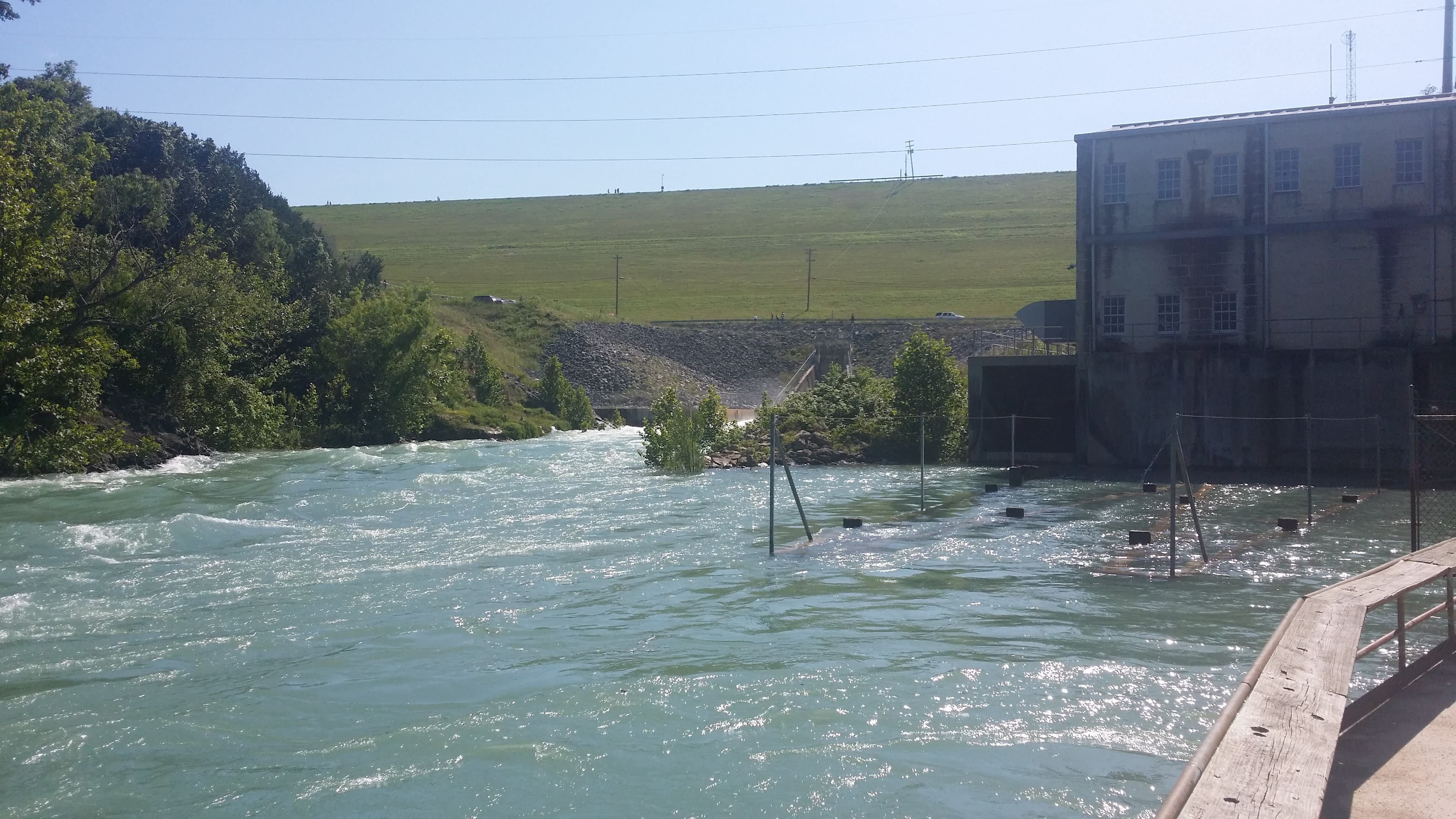
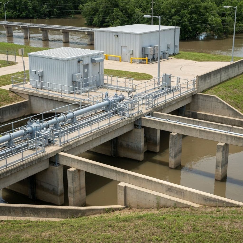
Dams, Reservoirs & Water Control
Continuous level monitoring with early-warning alerts for downstream communities. Reliable connectivity and long battery endurance suit remote water-control structures where infrastructure is limited.
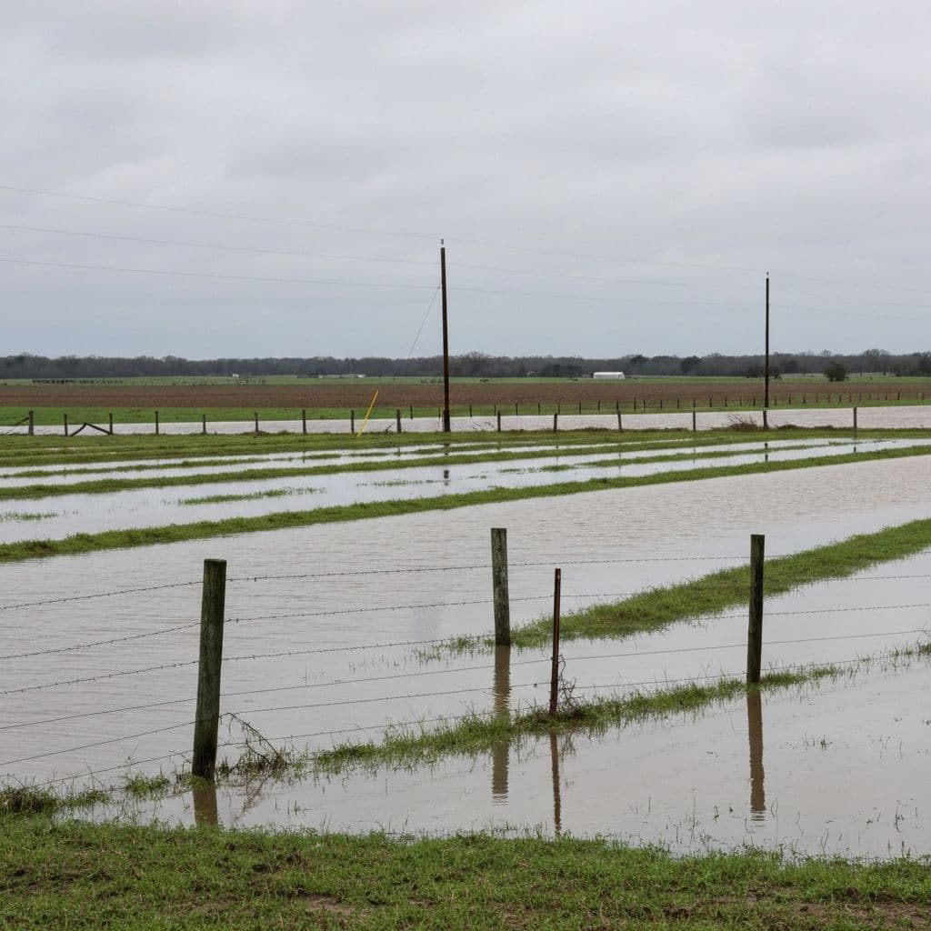
Managed Lands & Floodplains
Monitor flooding across federally managed lands, recreation areas, and floodplains, sharing real-time data with land managers, the public, and local emergency partners.
Why Federal Agencies Choose Levelynx
- Open API and standard data formats for national models and partner systems
- Satellite connectivity for the most remote monitoring sites
- Cost-effective hardware that stretches mitigation and grant funding
- Rapid deployment with no local infrastructure to build or maintain
- Multi-carrier and satellite redundancy for storm-long reliability
- Up to 6 months of battery backup at off-grid sites
- High-accuracy, continuous records for research and floodplain mapping
- Seamless data sharing with state, local, and tribal partners
Your Data Stays Yours
Public agencies are stewards of public data. Levelynx is built around transparency and portability — no hostage data, no mandatory portal, no surprises.
You Own All Collected Data
Every reading from every sensor belongs to your agency — not to us. We are the platform, you are the owner of record.
Data Export Available
Export your full dataset on demand in standard formats for reporting, analysis, or archival.
Open APIs
Documented, open APIs let you push data into your CAD, GIS, EOC, hydrologic models, and public dashboards.
No Vendor Lock-In
Open standards and exportable data mean you are never trapped. Your investment and your records stay portable.
Historical Archive Access
Retain and access the full historical record for trend analysis, capacity planning, and regulatory reporting.
Start With a Pilot, Not a Purchase Order
Prefer to see it work before funding a full rollout? Choose the evaluation path that fits your timeline and budget cycle. We're happy to start small and prove the value first.
30-Day Pilot
Deploy a small set of nodes at your most critical locations and see real data from your own sites within a month.
60-Day Evaluation
Run an extended evaluation across more locations and seasons to validate alerts, accuracy, and integrations before you commit.
Proof of Concept
Define success criteria with our team and prove the system against them — ideal for justifying a larger funded rollout.
Strengthen Federal Flood Monitoring
Talk with our team about extending reliable, open-data monitoring across your remote sites, reservoirs, and managed lands.