Flood Warning Built for Cities & Counties
Most flood fatalities happen on local roads that flood again and again — and the agencies responsible rarely have the budget for sprawling gauge networks. Levelynx gives cities, counties, and flood control districts an affordable way to monitor every dangerous crossing and warn residents before water reaches the road.
The Coverage Problem Local Governments Face
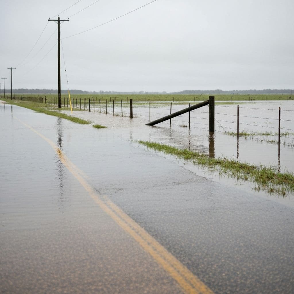
Counties and cities already know exactly where the water rises first — the low-water crossing on the county road, the creek behind the subdivision, the culvert that backs up every heavy rain. The problem has never been knowing where the danger is. It has been affordably covering all of it.
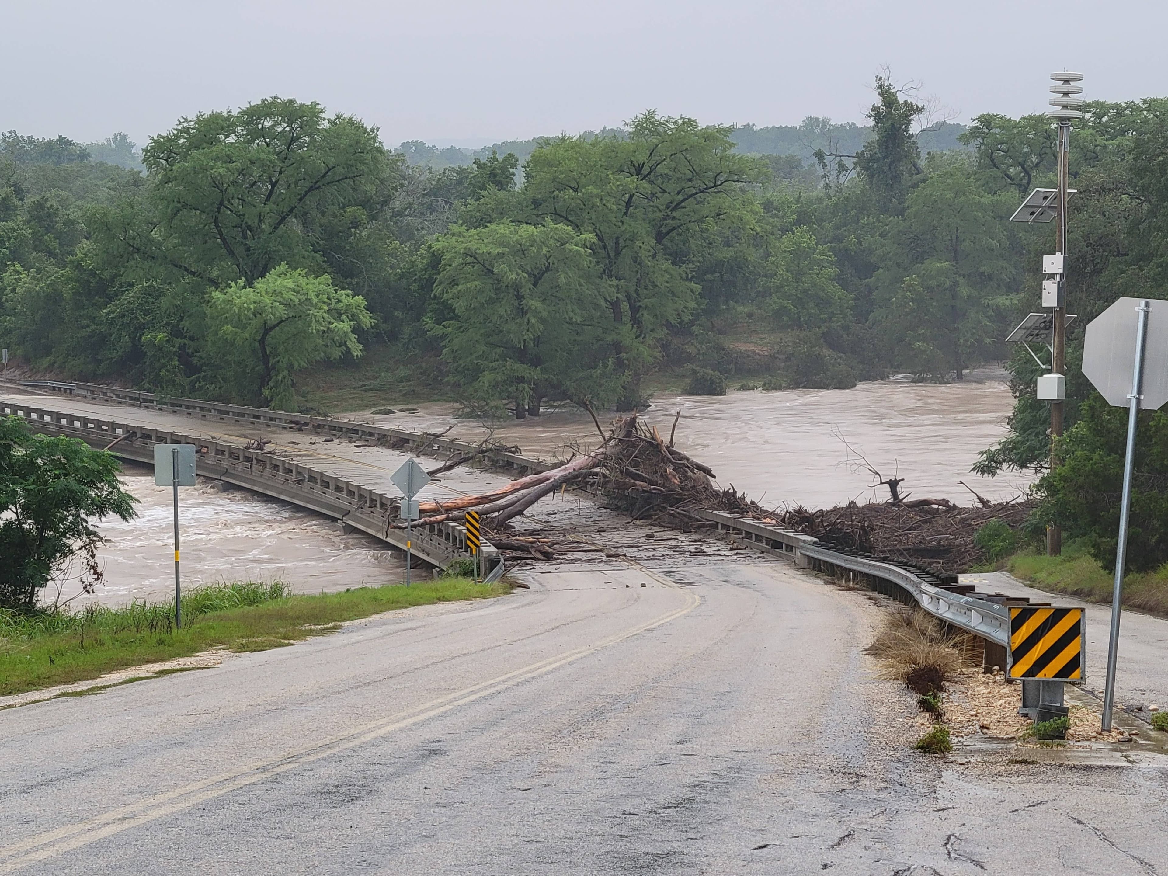
Traditional stream gauges are expensive, slow to install, and often depend on infrastructure that fails during the very storms that matter most. As a result, most flood-prone crossings go completely unmonitored, and the first warning a resident gets is the water in front of their car. Levelynx changes that math: low-cost nodes that deploy in under an hour and warn the public automatically.
What Stands in the Way Today
Tight Budgets
Legacy gauge networks cost too much per site to cover every crossing. Levelynx pricing and volume discounts fit municipal budgets so you can protect more locations.
Unmonitored Crossings
The deadliest low-water crossings often have no monitoring at all. Affordable nodes let you finally close those gaps across your jurisdiction.
Slow, Complex Installs
No contractors, permits, or radio infrastructure. Each solar-powered node mounts in under an hour and connects directly to the cloud.
Infrastructure Dependence
Multi-carrier cellular with satellite fallback means sites work even where there is no reliable network and even when towers go down in a storm.
Warning the Public in Time
Automated phone, SMS, email, and siren alerts reach residents and motorists the moment a threshold is crossed — no one has to be watching a screen.
Coordinating Road Closures
Integrations with flashing beacons, barrier arms, and signage help close dangerous roads automatically and feed your public works and emergency teams.
How Counties & Cities Use Levelynx
From a single problem crossing to a jurisdiction-wide network, Levelynx scales to fit the community you protect.
Low-Water Crossing Warnings
Monitor water depth at the crossings most likely to take a life. When the road becomes dangerous, Levelynx triggers automated public warnings, flashing beacons, and gate or barrier closures — protecting drivers before they ever reach the water.
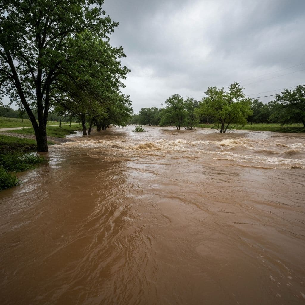
Neighborhood & Creek Monitoring
Place nodes across the creeks and drainage channels that threaten neighborhoods. Coordinated upstream-to-downstream data shows how a flood is developing and gives residents critical time to act.

Stormwater & Drainage Oversight
Watch detention ponds, culverts, and drainage channels for overflow conditions before they flood streets and property. Continuous records also support capacity planning and regulatory reporting.
Why Local Governments Choose Levelynx
- Budget-friendly pricing with volume discounts as your network grows
- Sites operational in under an hour — no contractors, permits, or radio infrastructure
- Automated public alerts via phone, SMS, email, and siren integration
- Multi-carrier cellular with automatic satellite fallback
- Up to 6 months of battery backup to ride out extended storms
- Sub-centimeter water-level accuracy you can act on with confidence
- Open API integration with CAD, GIS, EOC systems, and IPAWS
- Your data stays yours — no mandatory vendor portal or per-alert fees
Your Data Stays Yours
Public agencies are stewards of public data. Levelynx is built around transparency and portability — no hostage data, no mandatory portal, no surprises.
You Own All Collected Data
Every reading from every sensor belongs to your agency — not to us. We are the platform, you are the owner of record.
Data Export Available
Export your full dataset on demand in standard formats for reporting, analysis, or archival.
Open APIs
Documented, open APIs let you push data into your CAD, GIS, EOC, hydrologic models, and public dashboards.
No Vendor Lock-In
Open standards and exportable data mean you are never trapped. Your investment and your records stay portable.
Historical Archive Access
Retain and access the full historical record for trend analysis, capacity planning, and regulatory reporting.
Start With a Pilot, Not a Purchase Order
Prefer to see it work before funding a full rollout? Choose the evaluation path that fits your timeline and budget cycle. We're happy to start small and prove the value first.
30-Day Pilot
Deploy a small set of nodes at your most critical locations and see real data from your own sites within a month.
60-Day Evaluation
Run an extended evaluation across more locations and seasons to validate alerts, accuracy, and integrations before you commit.
Proof of Concept
Define success criteria with our team and prove the system against them — ideal for justifying a larger funded rollout.
Cover Every Crossing in Your Jurisdiction
Let's build a flood-warning network sized to your community and your budget. Talk with our team about a deployment plan for your most dangerous crossings.